Mono County, California


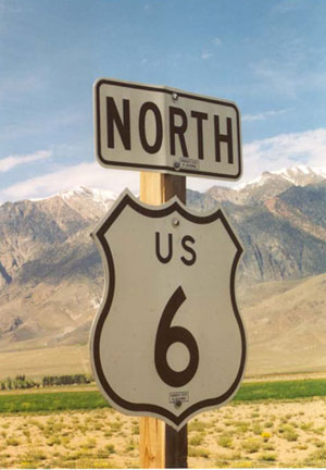
What, Route 6 North? Yes, the California Route 6 segment north of Bishop runs north-south. This and its companion sign on the other side of the highway (Route 6 South) were, as photographed in May 2003, the only Route 6 signs oriented North or South. Of course, before 1965 a long stretch of 6 was North-South, from the Nevada border to Long Beach.
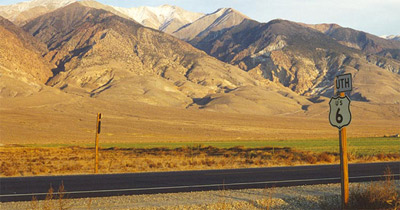
This is the view from across the road includes the Route 6 South sign in October 1997. In the far background are the White Mountains and Boundary Peak, the highest point in Nevada at 13,140 feet. At their feet are a series of spectacular alluvial fans.


Some would say that Route 6, coming out of Nevada from the east, enters Los Angeles in Mono County.  Through the Owens Valley on the east side of the Sierra, Route 6 closely parallels the path taken by the Los Angeles Aqueduct, which since 1913 has been something of an extension of the City of Angels. The map below, from William Mulholland and the Rise of Los Angeles (Catherine Mulholland, UC Press, 2000), shows the original 223-mile Aqueduct completed in 1913 from south of Big Pine to Los Angeles. The project, which brought water to a rapidly growing metropolitan area, created controversy in the Owens Valley and had a devistating effect on the region as the Owens River and Owens Lake dried-up.  In 1940, the aqueduct was extended forty more miles farther north to draw water from Mono Lake. In recent years the Los Angeles Department of Water and Power has taken numerous steps to reduce the environmental damage that the project caused. 


Back to California Counties Map