Western End of Route 6

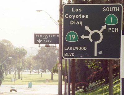
From 1937 to 1953 the western terminus was here at the traffic circle in Long Beach. For its last few miles, the highway actually headed east. This is a symmetrical pattern since Route 6 heads west for its last stretch on its eastern end on Cape Cod. From 1953 to 1965 the terminus was at the Long Beach Municipal Auditorium on Long Beach Boulevard. (April 2001 photo)
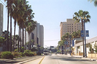
This May 2004 photo looks south to the end of Long Beach Boulevard, the western terminus of Route 6 from 1953 to 1965. Just behind the Long Beach Performing Arts Center at end of the Boulevard is the Pacific Ocean. Today the Boulevard hosts the southern end of the Blue Line light rail line, which connects downtown Long Beach with downtown Los Angeles, just as Route 6 did in the 50s and 60s.
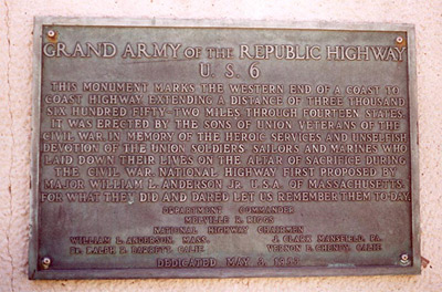
The plaque, dedicated On May 8, 1953, commemorates the end of the 3652-mile Route 6 in downtown Long Beach. It still can be found imbedded in the wall in front of the Performing Arts Center on Ocean Boulevard. Note that this 3652-mile length of Route 6 is quite a bit more that the 3517 miles specified on the old postcard at Provincetown. Whatever the total length was before the part south of Bishop was truncated, the great transcontinental is still over 3000 miles in length. (May 2004 photo)