|
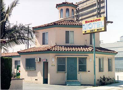 |
Pacific Coast Highway, which runs the
length of California in the form of Highway 101, shares the road with
Route 6 through Long Beach. Some auto tourist elements can be seen along
this stretch of road including the Beacon Motel, the name of which is a
reflection of the port status of Long Beach.
|
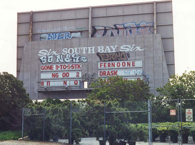
Among many drive-in theatres on Route
6, this was the largest with, appropriately, six screens. Soon after this
May 1999 photo was taken, it closed and was replaced with a K-Mart super
center. Location: about 200 blocks south of downtown Los Angeles on
Figueroa St. (May 1999 photo)
|
 |
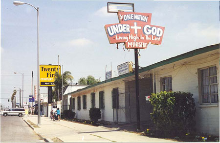 |
Route 6 extended for several miles
south out of downtown Los Angeles along a commercial strip having many
traditional tourist elements. Dozens of motels remain, although a number
of them are used for other purposes, including this church at 101st
Street. (May 1999 photo)
|
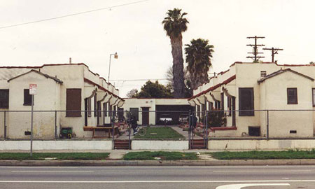
Some sections of housing exist along
Figueroa. Here are some classic Southern California courtyard homes. (May
1999 photo)
|
|
|
|
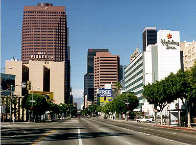
Route 6 zoomed past the University of
Southern California (about a mile south of downtown), then through
downtown Los Angeles on Figueroa Street. None of the
skyscrapers visible in this 1997 photo were there before 1965.
|
|
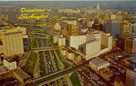
Above is an early 1960s postcard view of
downtown Los Angeles, taken just before a gaggle of tall skyscrapers began
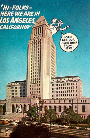
sprouting up. Since 1928 the tallest building that could have been
seen from Route 6 was City Hall, at 454 feet standing tall above the flat
skyline of LA in the upper right of this photo. City Hall has been
featured in many screen roles, including as police headquarters in
"Dragnet" TV series; as Clark Kent's Daily Planet in the old "Superman" TV
series; and being attacked by Martians in "War of the Worlds."
(1950s postcard, right) More on downtown LA can be found in USC
Geography's walking tour: http://college.usc.edu/geography/la_walking_tour/
|
|
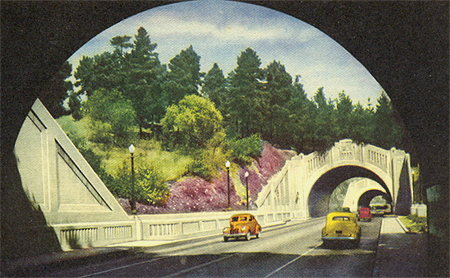 |
Figueroa Street and Route 6 zipped northward out of
downtown through these tunnels. Today they serve as the
north-bound half of the Pasadena Freeway, LA's first freeway.
(1930s postcard) |
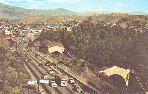 |
Here is a 1950s postcard, looking northeast,
that shows the incoming freeway lanes on the left and the tunnels on the
right. |
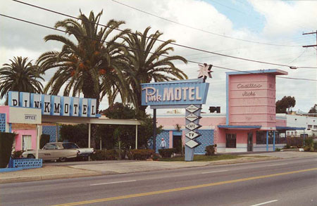
Northward out of downtown Los Angeles
through the San Fernando Valley, Route 6 shared Route 99 along San
Fernando Road. This April 2001 photo shows some classic California highway
scenes, the Pink Motel and its neighbor Cadillac Jacks Restaurant in Sun
Valley. The classic Ford Thunderbird adds an extra nice touch to this old
highway scene.
|
 |
|
|
Route 6 climbs northward out of Los
Angeles and the San Fernando Valley into the Antelope Valley on Sierra
Highway. This stretch has a "rural" feel to it, interrupted by a few
roadhouses and other small businesses. (October 1997 photo)
|
 Los Angeles County, California