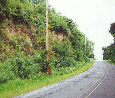
Two places in the world have thick layers of wind-blown material called Loess, Shaanxi, China and Western Iowa. The Loess Hills of Iowa stand up to 200 feet tall, paralleling the Missouri River. Loess, which contains a rich variety of minerals, stands up best in vertical (rather than sloped) road cuts. One such cut is on Mc{jerspm Avenue, old Route 6, just east of Council Bluffs, shown in this August 1999 photo.
 Pottawattamie County, Iowa

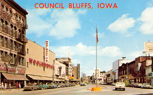
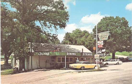
For Decades Route 6 has followed Broadway through Council Bluffs. Broadway in the downtown area, shown here in a 1960s postcard, is over three miles east of the Missouri River. Broadway between downtown and the river is a quintessential automobile commercial strip. Today, the only U. S. highway it carries is Route 6, but in the past it accomodated four of them (30A, 75, 275, and 6 in the 1940s).
|
|
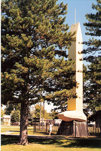
Located off Route 6, on the south side of Council Bluffs near the rail yards, is this rather large golden spike, symbolic of the role this city played in the transcontinental railroad. Several railroads converged here from the east to meet those headed west out of Omaha. The first was the Chicago and Northwestern, which arrived in 1867. In 1869 the Union Pacific completed the connection from Omaha to the meeting point with the Central Pacific in Utah, where a somewhat smaller golden spike was driven into the ground. The Rock Island Railroad arrived here in 1869, the day after the golden spike was driven, and a railroad bridge to Omaha was completed in 1872. |
|
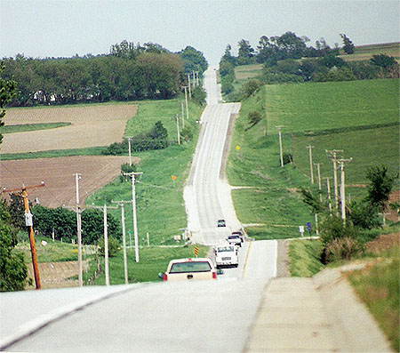
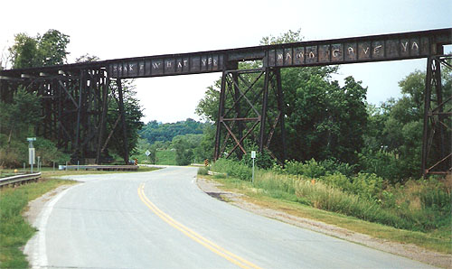
The serious highway explorer will take old Route 6 eastward out of the city. It follows McPherson Avenue for a few miles before meeting the newer 6. Along the way, old 6 passes under the Rock Island (now Iowa Interstate) railroad overpass. Route 6 closely parallels the Rock Island route through most of Illinois and Iowa. |
|