|
Morris is in the middle of a significant
transportation corridor. Two major nineteenth century components of
the corridor were the 1848 Illinois and Michigan Canal, which linked
the river to the lake, and the 1854 Chicago and Rock Island Railroad,
which connected the eastern rail network to the Mississippi River, and
eventually beyond. By the 1890s, in Illinois and most parts of the United
States, a rather full rail network connected most settlements of large or
medium size, and electric trolley networks within towns and cities
provided for local public transportation.
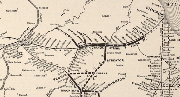
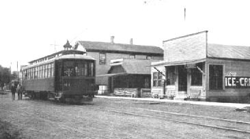
Then in the years around the turn of the
century, electricity-powered "interurban" trolleys were added to the
mix. They served a intermediate role between the steam trains and the
local trolleys, connecting small towns with more frequent service
than the steam railroads could provide. Interurban networks radiated
outward from many American cities, including Chicago and Los
Angeles. The above 1914 map shows one of numerous lines that
served the Chicago region, the Chicago, Ottawa, and Peoria. Its main
line paralleled the Rock Island Railroad and the Illinois River, serving
all of today's Route 6 towns from Joliet to Spring Valley. Two of
its branches connected these towns with other railroads: the
Burlington Route at Princeton and the Santa Fe at Streator.
The
interurban era in the Unted States was short-lived. By the 1920s,
when automobile ownership and paved highways were proliferating
rapidly, interurban lines began to close. Most did not last through
the depression of the 1930s. The automobile and the numbered
highways took over the role played by the interurbans in connecting small
towns to one another. (map courtesy of The University of Texas Libraries,
University of Texas at Austin) (to access the entire map, visit: http://www.lib.utexas.edu/maps/mcgraw_electric.html
)
|
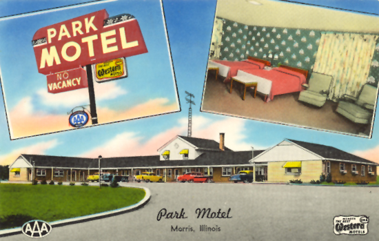
 Grundy County, Illinois