This
is a collaborative project among the following Route 6 aficionados: Curt and Libby Roseman of Moline, IL (formerly of Los Angeles, CA); and Kevin Patrick of Indiana, PA. Our contact is: croseman@usc.edu
For several years we have been collecting and compiling information on U. S. Highway 6, which in 1937 became a numbered transcontinental federal highway. From that date until 1965, Route 6 extended from Provincetown, Massachusetts at the very tip of Cape Cod to Long Beach, California. For that twenty-eight year period, it stretched 3662 miles and was the longest of the great transcontinentals. The second longest, Route 20, was (and still is) 3345 miles long (Weingroff, 1987). The length of the somewhat more famous Route 66 pales into insignificance because it was not transcontinental, extending a mere 2448 miles to Chicago from Santa Monica, California. Today, the western terminus of Route 6 is at Bishop, CA.
Our ongoing investigation of Route 6 emphasizes not only the road itself, but also its roadside landscapes and its regional and historical contexts. Most other highway research is primarily historical, including classic books on U. S. 40 (Stewart, 1953) and the Lincoln Highway (Hokanson 1988). Much of the scholarly work places emphasis on the origins and early evolution of highways, usually up to the period of transition from named to numbered highways in the 1920s, and on the historical components of the highway landscape that are still visible today. [In addition, numerous popular books and guides have appeared, such as Route 66: A Guidebook to the Mother Road by Moore and Grauwels (1966).]
We are interested in both
historical and contemporary aspects of Route 6. Clicking on the map at the
center of the front page of this Web site will lead you to a sampling of
scenes along the road and other Route 6 information
for each county, plus borders and end points. With a few exceptions, the images are arranged
from west to east (left to right on the map) on each county page, except
California where they are arranged from south to north.
 |
|
|
|
About UsAcknowledgements We thank Augustana College, Rock Island, Illinois, for helping create this Web site and hosting it from 2004 to 2010. The 2004 winter term cartography class at Augustana drew the maps for this site under the tutelage of Geography Instructor Cathy Dowd. Two members of that class made important additional contributions: Stephanie Ashe revised and refined the maps for use on the site and Gwen Facchina, using our material, designed the Web site. In addition, we thank Cathy Dowd and Charles Mahaffey, Augustana Geography Department Chair, for facilitating and supporting our work.
In 2010, Heritage Documentaries, Inc.
(www.heritagedocumentaries.org ) began hosting the
site. We thank Leslie DuPree and Shawn Beatty of Augustana
College and Dr. Ezra Sidran, a Heritage Board member, for their help
in making the transfer arrangements. More About Us
Curtis C. Roseman is Professor
Emeritus of Geography, University of Southern California, Elizabeth
M. Roseman is an independent scholar, and Kevin J. Patrick is Professor of
Geography and Regional Planning, Indiana University of Pennsylvania.
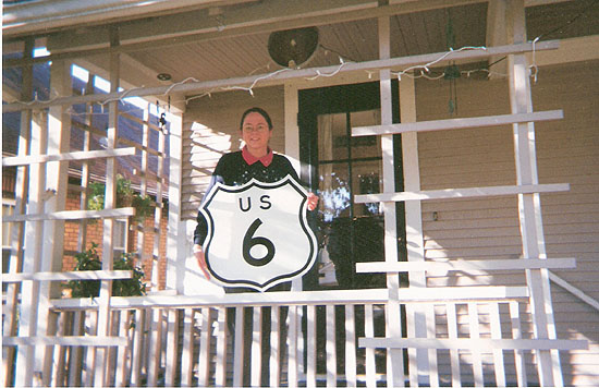
Below is Libby holding one of our most prized possessions.
|