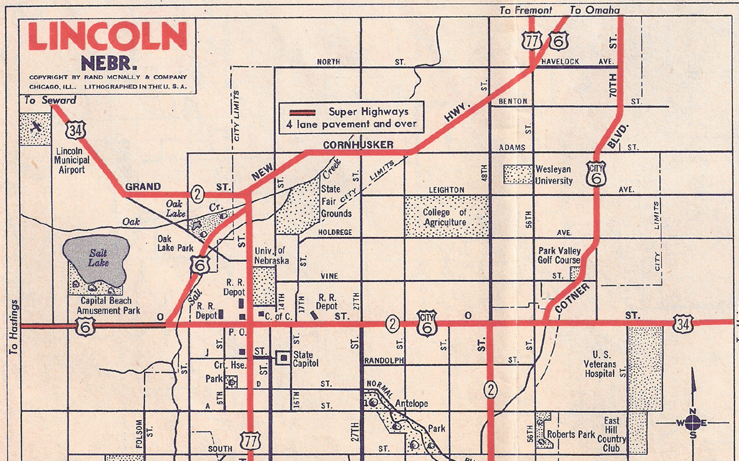
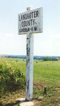
Lancaster County, Nebraska


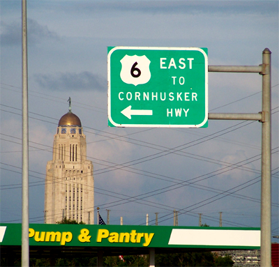
During the named-highway era, the current Route 6 through Nebraska was called the Omaha-Lincoln-Denver Highway (later to become the Detroit-Lincoln-Denver Highway). This eight-foot high sign west of Lincoln celebrates that history. (Left: July 1998 photo) From the 
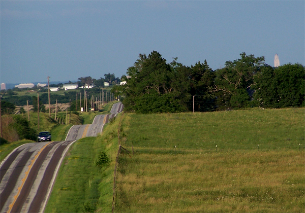
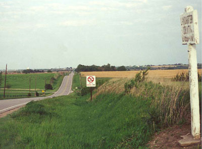
O-L-D sign, Route 6 undulates eastward toward Lincoln. (Above, May 2002 photo) 
 
On a clear day, the Nebraska state Capital (about 11 miles away and 400 feet tall) can be seen from this location.  The June 2010 photo below was taken from a few feet southeast of the sign. 


This postcard image shows downtown Lincoln in the 1950s, looking northward along 13th Street with the University of Nebraska in the far distance. The original Route 6 was perpendicular to this street on O Street, about two blocks north of the Cornusker Hotel. Later, when a Route 6 bypass followed Cornhusker Highway along the northwest edge of the city, the downtown route became City 6.  Today, City 6 is gone.


Just to the right of the photographer who shot the above picture postcard of downtown Lincoln is the Nebraska State Capitol building.  Designed by Bertram Goodhue, the 400-foot tall building was completed in 1932.  Goodhue also designed the downtown Los Angeles Public Library, now called the Richard Riordan Central Library, which is located one block from the former path of Route 6 on Figueroa Street.  (Curt Teich Postcard Archives, Lake County Illinois Discovery Museum)


The main campus of the University of Nebraska is located just north of downtown Lincoln.  This 1940s postcard view looking northeast shows the diagonal railroad lines and companion Cornhusker Highway on the left, which by this time was carrying Route 6.  A prominent feature of the campus was Memorial Stadium, completed in 1923 to seat 31,000 Cornhusker football fans. It looks very different today, having been expanded in several increments beginning in 1964. Today's games, which are always sold out, attract over 85,000 fans each. (Curt Teich Postcard Archives, Lake County Illinois Discovery Museum)


This 1940s Mobiloil Nebraska road map shows the configuration of Route 6 and City 6 in Lincoln.  City 6 zoomed through downtown on O Street, while 6 followed an early two-lane bypass along Cornhusker Highway.  Similar bypasses were routed around Hastings, Nebraska and Des Moines and Davenport, Iowa.  Note the stretch of four-lane "Super Highway" headed west out of town. 


Route 6 enters Lincoln on West O Street, the "Super Highway," then turns toward the northeast and Omaha on Cornhusker Highway. (June 2010 photo)


The old Chicago, Rock Island & Pacific Railroad breifly encounters Route 6 in Nebraska.  Here is the old Rock Island depot at 29th and O Street in Lincoln.  The building has been nicely restored and functions as a bank. In the lower right-hand corner of the photo on the right is one of the Railroad's seventieth anniversary plaques, which were placed near most of their depots in 1922.  Along Route 6, such plaques remain in West Liberty, Iowa, and Sheffield, Illinois, and probably some other places. (June 2010 photos) 


What would a Route 6 tour be without a Motel 6 sign? In May 2000 this 6 on 6 was on the northeast side of Lincoln, just off Cornhusker Highway near the historic Havelock neighborhood. However the symmetry was not to last: as of May 2005, this motel had become a Travel Lodge.


Back to Nebraska Counties Map